
ALTA/NSPS
Survey-ready aerial outputs for title and land use - SURVAIR supports licensed surveyors and title professionals with drone-based orthomosaics and CAD layers that reduce field time, improve clarity, and meet ALTA/NSPS mapping standards with precision.
.png)
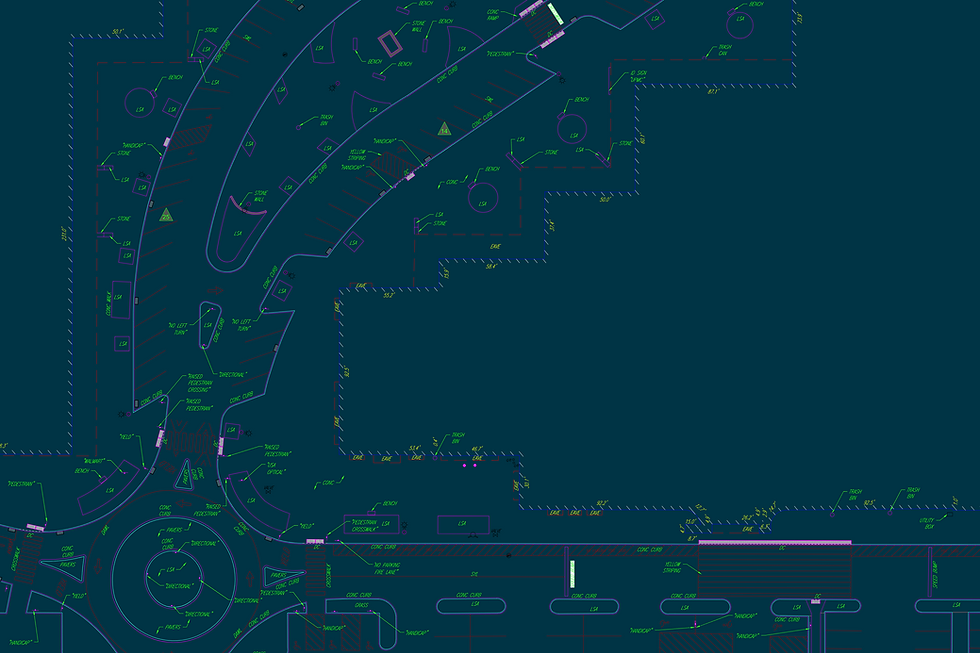
CAD-Ready Layered Files
DXF and DWG formats prepared for integration into boundary, easement, & improvement maps.
Orthomosaics for Title Reviews
High-resolution aerial imagery aligned to known control points for legal site clarity.
Surveyor Collaboration
Data captured under FAA-certified operations and reviewed by PLS for compliance.
Encroachment and Easement Checks
Detailed overlays highlight property edges, structures, and potential boundary conflicts.
Field Time Reduction
Cover large or complex sites quickly while maintaining data defensibility and survey accuracy.
SURVAIR brings high-resolution drone data to the ALTA/NSPS process, helping surveyors and legal teams document property boundaries faster and more clearly.
By replacing traditional on-foot observation with precise aerial visuals, we support defensible documentation that reduces delays, improves accuracy, and brings confidence to commercial transactions.


Aerial Perspectives
Aerial Mapping That Supports Legal and Land Compliance
SURVAIR’s ALTA/NSPS service provides high-accuracy aerial mapping and base files that align with American Land Title Association and National Society of Professional Surveyors standards. Using RTK-enabled drones and licensed oversight, we capture clear orthomosaics and annotated data layers optimized for legal, engineering, and boundary documentation.
Our deliverables reduce the need for extended fieldwork and provide clean, CAD-ready layers that integrate directly into your ALTA/NSPS survey packages - saving time while meeting the strict documentation needs of commercial title transactions and land assessments.
View our sample projects


What Makes Our ALTA Mapping Reliable
Let's Elevate Your Data
Ready to unlock the power of aerial environmental intelligence?